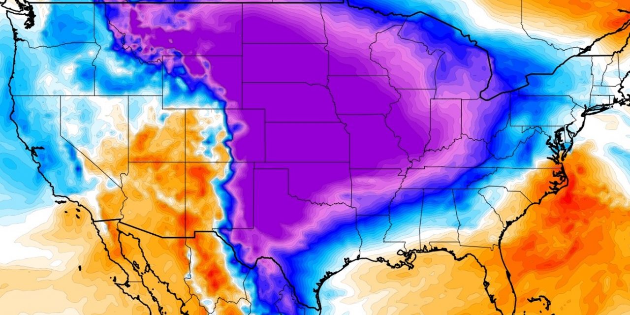
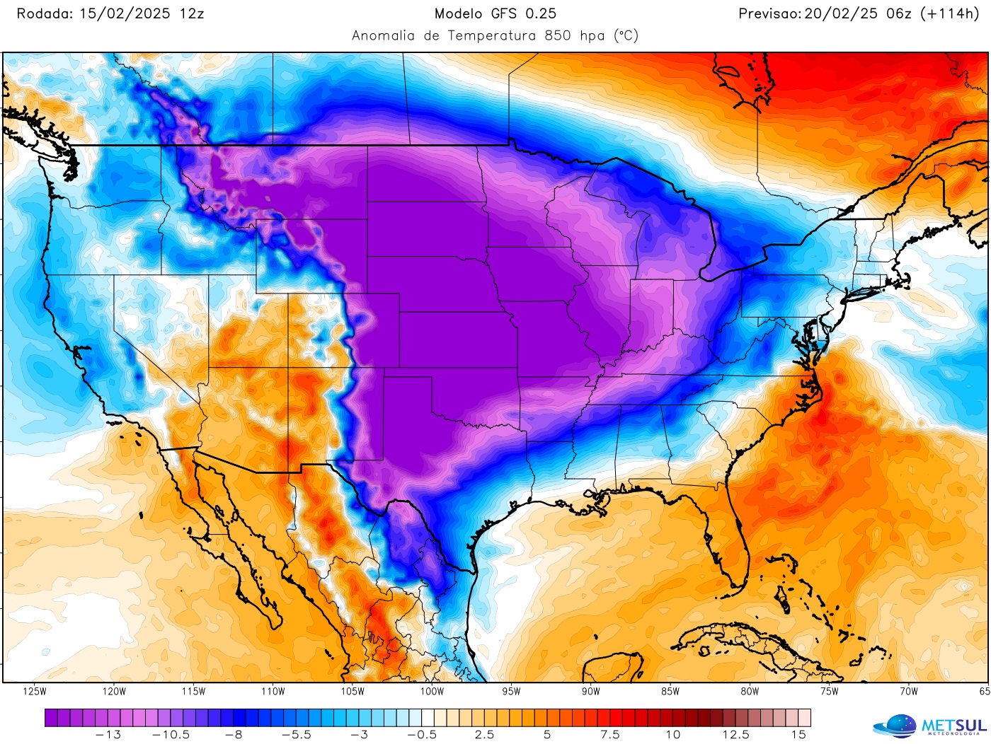
A powerful Arctic air mass will sweep across the central United States, bringing dangerously low temperatures and life-threatening wind chills to millions of people next week.
METSUL
Meteorologists warn that wind chills will drop to -40°F (-40°C) in states like North Dakota and Montana, with Chicago expected to reach -20°F to -30°F (-29°C to -34°C).
The Arctic air will push south, bringing freezing temperatures to Oklahoma, Tennessee, and even Texas. By Thursday, parts of the Gulf Coast could experience frost and icy conditions.
The National Weather Service warns of frostbite risks and hypothermia. Residents should limit outdoor exposure, dress in layers, and protect vulnerable people, pets, and exposed pipes.
Record-breaking cold is possible in Missouri, Arkansas, Oklahoma, and Kansas. Cities like Dallas could experience wind chills below zero, making this one of the coldest outbreaks this winter.
Potential Blizzard Threatens the East Coast
A major snowstorm could develop along the East Coast next week, with some weather models predicting a powerful nor’easter capable of producing blizzard conditions from Washington, D.C., to Boston.
The storm’s exact track remains uncertain, but heavy snowfall is likely in parts of the Northeast. Some areas could see over a foot of snow accumulation.
Strong winds will accompany the storm, potentially causing whiteout conditions, power outages, and dangerous travel. Coastal flooding and beach erosion may also impact parts of New England.
Meteorologists expect cold air from the Arctic outbreak to collide with Gulf moisture, fueling the storm. Some models predict a severe blizzard with widespread impacts.
The National Weather Service warns residents to prepare for significant disruptions. Travelers should monitor forecasts closely, as flight cancellations and road closures are highly possible.
Polar Vortex Fuels Extreme Cold and Storms
The return of the polar vortex is responsible for the extreme cold and stormy weather across the United States. This phenomenon occurs when Arctic air shifts southward.
A Greenland high-pressure system is forcing cold air into North America, causing temperatures to drop 40°F below normal in many areas, from Montana to Texas.
The coldest temperatures will hit the Midwest and Great Plains early next week. By Tuesday, millions of people across the central and eastern U.S. will face subzero conditions.
Strong winds will create brutal wind chills, making outdoor exposure dangerous. Frostbite can occur within minutes, especially in states experiencing temperatures of -30°F or lower.
The combination of extreme cold and heavy snowfall could lead to power outages. Officials urge residents to have emergency supplies, including food, water, and extra heating sources.
Looking Ahead: When Will It Warm Up?
The Arctic blast is expected to last through next week, with some areas remaining below freezing until late February. Warmer conditions may return by the last week of the month.
Long-range forecasts suggest temperatures could gradually rebound, but another storm system may develop in the central U.S. before the cold pattern fully weakens.
Meteorologists are closely watching the potential for more winter storms. If moisture from the Gulf interacts with lingering cold air, additional snowfall could impact the Midwest and Northeast.
For now, residents should prepare for the worst, with extreme cold, strong winds, and possible blizzards. Winter’s last hurrah is shaping up to be brutal.